
Reading Time: 12 Minutes
Difficulty Level: Beginner to Intermediate
Reviewed By: FinanceInfoIn Editorial Team.
How Flood Zones & Hazard Maps Affect Your Property Decisions
Staring at a massive premium bill for a property I had not even moved into yet felt like a direct punch to the gut. The home inspector praised the solid foundation, and the neighborhood looked absolutely perfect to my untrained eye. But a hidden digital line on a county map changed everything in a matter of seconds.
Suddenly, my affordable dream home came with a hidden cost that my regular monthly budget simply could not handle. I had already scraped together every penny just to cover the standard closing costs. There was absolutely no room for an extreme insurance hike right at the finish line.
That sinking feeling in the pit of my stomach taught me a very expensive, painful lesson about location. Buying a home is not just about the structure itself. It is entirely about the ground beneath it and the environmental threats surrounding it.

Table of Contents
- The Hidden Reality of Buying High-Risk Homes
- Decoding Environmental Threat Maps
- Real-Life Math: The True Cost of High-Risk Areas
- Standard Coverage vs. Hazard Specific Policies
- The Honest Pros and Cons
- Step-by-Step Guide to Checking Your Next Home
- Navigating Property Risks Like a Seasoned Investor
- Common Mistakes to Avoid When Evaluating Property Terrain
- Your Blueprint for Checking Any Home's Real Elevation
- Common Questions About Property Water Risks and Hazard Maps
- A Final Word on Buying Smart and Staying Safe
Quick Summary
Buying a property without checking local hazard maps can lead to devastating financial surprises. Hidden boundary lines dictate mandatory insurance policies that can destroy your monthly budget. Understanding the true elevation and risk factors protects your family's safety and your wallet. Always verify environmental threats before signing any real estate contract.
Key Takeaways
- Boundary lines on a map can drastically increase your monthly housing expenses.
- Standard home insurance policies almost never cover water damage from outside flooding.
- Properties in high-risk areas often face significant difficulties during resale.
- Checking local environmental mapping tools is a non-negotiable step in buying real estate.
The Hidden Reality of Buying High-Risk Homes
We often fall in love with a property based on its visual appeal. You see the updated kitchen, the large backyard, and the quiet street. But nature does not care about granite countertops or freshly painted walls.
When heavy rain starts pouring, the only thing that matters is your elevation. Families living in mapped danger areas experience a unique kind of daily anxiety. Every time the local news announces a severe weather warning, their heart rates spike.
They are not just worried about getting wet. They are terrified of losing their life savings overnight. The financial burden of repairing a waterlogged home can bankrupt a normal working-class family.

Living with this constant stress ruins the joy of homeownership. You find yourself obsessively checking weather apps instead of enjoying your weekend. The emotional toll is just as heavy as the financial one.
Many buyers are completely blind to these risks until it is too late. Real estate listings rarely advertise the negative aspects of a location. It is entirely up to you to uncover the truth hidden in the local records.
Decoding Environmental Threat Maps
Understanding exactly what you are looking at is your first line of defense. Maps created by government agencies use specific codes to classify danger levels. These codes might look like random letters, but they hold the key to your financial future.
The boundaries are drawn based on historical data and geographical features. If your potential home falls just one inch inside a specific boundary, your obligations change entirely.
Let us break down the most common classifications you will encounter. Knowing these categories helps you speak the same language as your lender and agent.
Real-Life Math: The True Cost of High-Risk Areas
To truly understand how this affects your wallet, let us look at a realistic scenario. Meet David, a first-time buyer looking at a beautiful property priced at $300,000. He is thrilled because the monthly mortgage payment fits perfectly into his budget.
However, David's chosen property sits squarely in a high-risk Zone AE. His standard home policy costs roughly $1,200 annually. Because of the map boundary, his lender demands an additional specialized policy costing $2,500 every single year.
This hidden requirement adds roughly $208 to his monthly housing expense. Over a standard 30-year mortgage, David will pay an extra $75,000 just for the privilege of living in that specific spot. That is money he could have invested, saved for retirement, or used for his children's education.
Standard Coverage vs. Hazard Specific Policies
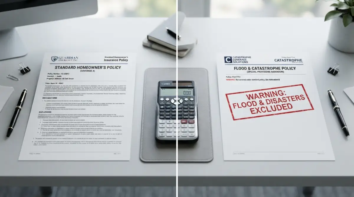
One of the biggest traps buyers fall into is misunderstanding their protection. People naturally assume that a standard homeowners policy covers all types of damage. This is a very dangerous and incredibly common misconception.
If a pipe bursts inside your kitchen, your regular policy usually handles the mess. However, if a nearby river overflows and pushes mud into your living room, you are entirely on your own.
You must clearly understand the difference between these financial safety nets. Mixing them up can leave you completely exposed during a disaster.
Watch this breakdown to quickly spot hidden red flags before making an offer.
The Honest Pros and Cons
Every real estate decision involves weighing the good against the bad. Properties near the water or nestled deep in forested hills are undeniably beautiful. They offer a lifestyle that many people dream of.
However, you have to look past the beautiful scenery and evaluate the long-term reality. Below is a clear look at both sides of the coin.
The Pros:
- Lower initial purchase price compared to completely safe zones.
- Stunning natural views and direct access to waterways.
- Unique architectural styles often built specifically for the environment.
- Less neighborhood density in certain vulnerable coastal regions.
The Cons:
- Exorbitant insurance premiums that increase almost every year.
- Severe difficulty selling the property later when you want to move.
- Strict and expensive building codes if you want to renovate.
- The constant emotional dread during storm seasons.
Expert Tip:
I once walked away from a gorgeous waterfront property just three days before closing. The seller's agent kept telling me the water had not reached the house in fifty years. But I realized that history does not guarantee future safety, especially with changing weather patterns. My biggest realization was that buying peace of mind is far more valuable than buying a pretty view. I gladly lost my inspection fee to save myself from decades of anxiety.
Step-by-Step Guide to Checking Your Next Home
You should never rely solely on a seller's word when making a massive financial commitment. You need to take the investigation into your own hands. Thankfully, the tools you need are easily accessible if you know where to look.
Investigate the Official Federal Portals
Your very first stop should always be the government database. Type the exact property address into the official mapping center to see the designated boundaries. Look closely at how close the lines get to the actual foundation of the house.
Sometimes, the yard is in a high-risk area while the actual house sits on higher ground. This small detail can completely change your lending requirements. Always print or save these digital documents for your personal files.
Consult Independent Local Professionals
Do not just trust the internet; talk to people who actually work in the neighborhood. Call three different local insurance agents and ask for a mock quote on the address. If they hesitate or quote a massive number, consider that a giant red flag.
You can also speak with neighbors who have lived on the street for a long time. Ask them directly if water ever pools in their driveways or basements during the spring.
Check the Base Elevation Certificate
If the home is near a danger boundary, request the official elevation document. This certificate proves exactly how high the lowest floor of the home sits above the expected water level.
If the current owner does not have one, you might have to pay a surveyor to create it. It is an extra upfront cost, but it is absolutely necessary for an accurate insurance quote.
Analyze the Resale Market Data
Take a hard look at how long properties in that specific neighborhood sit on the market. If homes there take twice as long to sell, you will face the exact same problem later.
A home is supposed to be a safe investment that grows your wealth. If the environmental risks make it impossible to sell, your money is completely trapped. Always buy a home with your future exit strategy in mind.
Protecting your financial future requires careful research and a willingness to walk away from bad deals. Never let emotions push you into signing a contract for a vulnerable property. By checking the maps and doing the math, you ensure your dream home remains a blessing, not a burden.

Navigating Property Risks Like a Seasoned Investor
When you are about to spend hundreds of thousands of dollars on a property, surface-level research simply is not enough. You need to look at a home through the eyes of a conservative investor who protects their cash at all costs. The local mapping tools are a great starting point, but they only tell you the current expected threat level.
Smart buyers dig deeper by looking at historical changes and municipal drainage plans. A street might look perfectly dry on a sunny Tuesday afternoon during your private showing. However, if the city has poorly maintained storm drains at the end of that block, a heavy spring storm will push that water straight into your driveway.
You also want to look closely at how the neighboring houses are built. Do they have their HVAC units raised on thick concrete blocks? Are the basement windows heavily sealed with thick plastic covers? These small physical clues often reveal the environmental threats that the seller is trying to downplay.
Always check if the property sits at the bottom of a subtle slope. Even if a house is technically outside the government-designated danger zone, gravity will always pull surface water downward. If you are at the lowest point in a neighborhood, you become the unofficial collection bowl for everyone else's runoff.
Pro Tip: Always ask the seller for their current insurance declaration page during the negotiation phase. If they refuse to show what they are paying for hazard coverage, they are likely hiding a massive premium that will soon become your very expensive problem.
Understanding these nuances helps you see past the fresh paint and staging furniture. You have to separate your emotions from the physical reality of the land. Here is a clear look at what people believe versus the actual truth.
Myth vs. Reality: The Truth About Environmental Threats
The Trap of Ignorance: Where Most Buyers Lose Their Money
We all want to believe the best about a beautiful house when we are emotionally attached to it. That emotional attachment often leads buyers to ignore glaring red flags just to get the deal done. I have seen families wipe out their entire savings account because they rushed through the due diligence period.
If you do not take these threats seriously, the financial consequences will haunt you for decades. You could easily find yourself paying an extra thousand dollars a month just to keep your lender happy. That is exactly what no one tells you about the true cost of your first home before you sign the contract.
Common Mistakes to Avoid When Evaluating Property Terrain
- Trusting verbal history over digital data: Believing a real estate agent who says "it never pools here" without checking the official municipal maps.
- Skipping the independent surveyor: Trying to save a few hundred dollars by not getting a fresh elevation certificate, which later results in thousands of dollars in overcharged premiums.
- Ignoring the basement smell: Dismissing a faint musty odor in the lower levels as just "old house smell" when it actually indicates chronic moisture intrusion.
- Failing to check the foundation: Not looking for horizontal cracks or water stains along the exterior concrete base. These are major warning signs to spot in a home inspection that should never be ignored.
The emotional toll of these mistakes is just as bad as the financial drain. Living in constant fear of the next rainstorm completely destroys the peace of a happy home. You end up spending your weekends buying sandbags instead of relaxing with your family.